Vy-lès-Lure | |
|---|---|
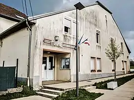 The town hall in Vy-lès-Lure | |
.svg.png.webp) Coat of arms | |
Location of Vy-lès-Lure | |
 Vy-lès-Lure  Vy-lès-Lure | |
| Coordinates: 47°38′53″N 6°26′52″E / 47.6481°N 6.4478°E | |
| Country | France |
| Region | Bourgogne-Franche-Comté |
| Department | Haute-Saône |
| Arrondissement | Lure |
| Canton | Lure-2 |
| Intercommunality | Pays de Lure |
| Government | |
| • Mayor (2020–2026) | Christine Descollonges[1] |
| Area 1 | 16.00 km2 (6.18 sq mi) |
| Population | 707 |
| • Density | 44/km2 (110/sq mi) |
| Time zone | UTC+01:00 (CET) |
| • Summer (DST) | UTC+02:00 (CEST) |
| INSEE/Postal code | 70581 /70200 |
| Elevation | 275–359 m (902–1,178 ft) |
| 1 French Land Register data, which excludes lakes, ponds, glaciers > 1 km2 (0.386 sq mi or 247 acres) and river estuaries. | |
Vy-lès-Lure (French pronunciation: [vi lɛ lyʁ], literally Vy near Lure) is a commune in the Haute-Saône department in the region of Bourgogne-Franche-Comté in eastern France.
Coal mines were operated in the village until the 1940s.
Population
| Year | Pop. | ±% p.a. |
|---|---|---|
| 1968 | 514 | — |
| 1975 | 437 | −2.29% |
| 1982 | 514 | +2.35% |
| 1990 | 544 | +0.71% |
| 1999 | 555 | +0.22% |
| 2007 | 614 | +1.27% |
| 2012 | 677 | +1.97% |
| 2017 | 676 | −0.03% |
| Source: INSEE[3] | ||
See also
References
- ↑ "Répertoire national des élus: les maires". data.gouv.fr, Plateforme ouverte des données publiques françaises (in French). 2 December 2020.
- ↑ "Populations légales 2021". The National Institute of Statistics and Economic Studies. 28 December 2023.
- ↑ Population en historique depuis 1968, INSEE
Wikimedia Commons has media related to Vy-lès-Lure.
This article is issued from Wikipedia. The text is licensed under Creative Commons - Attribution - Sharealike. Additional terms may apply for the media files.