Winneboujou, Wisconsin | |
|---|---|
 Winneboujou  Winneboujou | |
| Coordinates: 46°31′03″N 91°36′04″W / 46.51750°N 91.60111°W | |
| Country | |
| State | |
| County | Douglas |
| Town | Brule |
| Elevation | 313 m (1,027 ft) |
| Time zone | UTC-6 (Central (CST)) |
| • Summer (DST) | UTC-5 (CDT) |
| Area code(s) | 715 and 534 |
| GNIS feature ID | 1577890[1] |
Winneboujou is an unincorporated community, located in the town of Brule, Douglas County, Wisconsin, United States.
The community is located 3 miles east of Lake Nebagamon; and 33 miles east-southeast of the city of Superior.
Winneboujou is located at the junction of Wisconsin Highway 27 and County Road B.[2]
The community is named after Winneboujou, a character from the Ojibwa traditional stories.
References
- 1 2 U.S. Geological Survey Geographic Names Information System: Winneboujou, Wisconsin
- ↑ Douglas Co (pdf) (Map). Wisconsin Department of Transportation. Retrieved July 7, 2010.
Municipalities and communities of Douglas County, Wisconsin, United States | ||
|---|---|---|
| City | 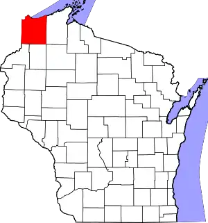 | |
| Villages | ||
| Towns | ||
| CDPs | ||
| Unincorporated communities |
| |
| Indian reservation | ||
| Ghost towns | ||
| Footnotes | ‡This populated place also has portions in an adjacent county or counties | |
This article is issued from Wikipedia. The text is licensed under Creative Commons - Attribution - Sharealike. Additional terms may apply for the media files.