| Yoshii River 吉井川 | |
|---|---|
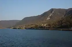 Yoshii River in 2007 | |
| Location | |
| Country | Japan |
| State | Honshu |
| Region | Okayama |
| Physical characteristics | |
| Source | Mount Mikuni |
| • elevation | 1,252 m (4,108 ft) |
| Mouth | Seto Inland Sea |
• coordinates | 34°36′15″N 134°02′16″E / 34.6042°N 134.0378°E |
| Length | 133 km (83 mi) |
| Basin size | 2,110 km2 (810 sq mi) |
The Yoshii River is a river in Okayama Prefecture, Japan.[1]
References
- ↑ "吉井川(よしいがわ)とは - コトバンク". kotobank.jp. Retrieved 2017-12-30.
Wikimedia Commons has media related to Yoshii River.
| |||||||||||||||
| |||||||||||||||
| |||||||||||||||
| |||||||||||||||
| |||||||||||||||
This article is issued from Wikipedia. The text is licensed under Creative Commons - Attribution - Sharealike. Additional terms may apply for the media files.