Réguisheim | |
|---|---|
 The town hall in Réguisheim | |
.svg.png.webp) Coat of arms | |
Location of Réguisheim | |
 Réguisheim 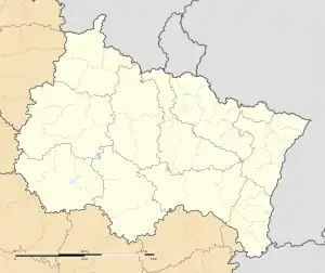 Réguisheim | |
| Coordinates: 47°53′52″N 7°21′24″E / 47.8978°N 7.3567°E | |
| Country | France |
| Region | Grand Est |
| Department | Haut-Rhin |
| Arrondissement | Thann-Guebwiller |
| Canton | Ensisheim |
| Intercommunality | Centre Haut-Rhin |
| Government | |
| • Mayor (2020–2026) | Frank Paulus[1] |
| Area 1 | 23.87 km2 (9.22 sq mi) |
| Population | 2,023 |
| • Density | 85/km2 (220/sq mi) |
| Time zone | UTC+01:00 (CET) |
| • Summer (DST) | UTC+02:00 (CEST) |
| INSEE/Postal code | 68266 /68890 |
| Elevation | 209–219 m (686–719 ft) (avg. 212 m or 696 ft) |
| 1 French Land Register data, which excludes lakes, ponds, glaciers > 1 km2 (0.386 sq mi or 247 acres) and river estuaries. | |
Réguisheim (French pronunciation: [ʁegisaim] ⓘ; German: Regisheim) is a commune in the Haut-Rhin department in Grand Est in north-eastern France.
Population
| Year | Pop. | ±% p.a. |
|---|---|---|
| 1968 | 1,239 | — |
| 1975 | 1,304 | +0.73% |
| 1982 | 1,612 | +3.08% |
| 1990 | 1,536 | −0.60% |
| 1999 | 1,660 | +0.87% |
| 2007 | 1,736 | +0.56% |
| 2012 | 1,810 | +0.84% |
| 2017 | 1,895 | +0.92% |
| Source: INSEE[3] | ||
See also
References
- ↑ "Répertoire national des élus: les maires" (in French). data.gouv.fr, Plateforme ouverte des données publiques françaises. 13 September 2022.
- ↑ "Populations légales 2021". The National Institute of Statistics and Economic Studies. 28 December 2023.
- ↑ Population en historique depuis 1968, INSEE
Wikimedia Commons has media related to Réguisheim.
This article is issued from Wikipedia. The text is licensed under Creative Commons - Attribution - Sharealike. Additional terms may apply for the media files.