Tagolsheim | |
|---|---|
 The town hall in Tagolsheim | |
.svg.png.webp) Coat of arms | |
Location of Tagolsheim | |
 Tagolsheim 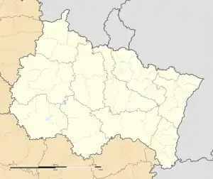 Tagolsheim | |
| Coordinates: 47°39′22″N 7°16′15″E / 47.6561°N 7.2708°E | |
| Country | France |
| Region | Grand Est |
| Department | Haut-Rhin |
| Arrondissement | Altkirch |
| Canton | Altkirch |
| Intercommunality | Sundgau |
| Government | |
| • Mayor (2020–2026) | Hervé Wermuth[1] |
| Area 1 | 3.19 km2 (1.23 sq mi) |
| Population | 976 |
| • Density | 310/km2 (790/sq mi) |
| Time zone | UTC+01:00 (CET) |
| • Summer (DST) | UTC+02:00 (CEST) |
| INSEE/Postal code | 68332 /68720 |
| Elevation | 262–367 m (860–1,204 ft) (avg. 265 m or 869 ft) |
| 1 French Land Register data, which excludes lakes, ponds, glaciers > 1 km2 (0.386 sq mi or 247 acres) and river estuaries. | |
Tagolsheim is a commune in the Haut-Rhin department in Alsace in north-eastern France.
Population
| Year | Pop. | ±% p.a. |
|---|---|---|
| 1968 | 460 | — |
| 1975 | 625 | +4.48% |
| 1982 | 698 | +1.59% |
| 1990 | 691 | −0.13% |
| 1999 | 662 | −0.48% |
| 2007 | 668 | +0.11% |
| 2012 | 741 | +2.10% |
| 2017 | 928 | +4.60% |
| Source: INSEE[3] | ||
See also
References
- ↑ "Répertoire national des élus: les maires" (in French). data.gouv.fr, Plateforme ouverte des données publiques françaises. 13 September 2022.
- ↑ "Populations légales 2021". The National Institute of Statistics and Economic Studies. 28 December 2023.
- ↑ Population en historique depuis 1968, INSEE
Wikimedia Commons has media related to Tagolsheim.
This article is issued from Wikipedia. The text is licensed under Creative Commons - Attribution - Sharealike. Additional terms may apply for the media files.