 | |
|---|---|
| Bóthar R389 | |
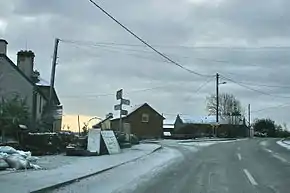 R389 passing through Castletown Geoghegan | |
| Route information | |
| Length | 21.7 km (13.5 mi) |
| Major junctions | |
| From | |
Passes through Castletown Geoghegan Crosses River Brosna | |
| To | |
| Location | |
| Country | Ireland |
| Highway system | |
The R389 road is a regional road in Ireland, located in County Westmeath.[1][2]
References
- ↑ "R389 - Roader's Digest: The SABRE Wiki". sabre-roads.org.uk. Retrieved 5 February 2016.
- ↑ "S.I. No. 54/2012 - Roads Act 1993 (Classification of Regional Roads) Order 2012". irishstatutebook.ie. Retrieved 5 February 2016.
53°26′09″N 7°29′00″W / 53.435861°N 7.483323°W
This article is issued from Wikipedia. The text is licensed under Creative Commons - Attribution - Sharealike. Additional terms may apply for the media files.