Saint-Joachim | |
|---|---|
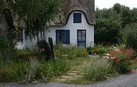 A Briéronne house on the island of Fédrun | |
Location of Saint-Joachim | |
 Saint-Joachim 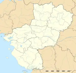 Saint-Joachim | |
| Coordinates: 47°22′59″N 2°11′58″W / 47.3831°N 2.1994°W | |
| Country | France |
| Region | Pays de la Loire |
| Department | Loire-Atlantique |
| Arrondissement | Saint-Nazaire |
| Canton | Guérande |
| Intercommunality | CA Région Nazairienne et Estuaire |
| Government | |
| • Mayor (2020–2026) | Raphaël Salaün[1] |
| Area 1 | 86.22 km2 (33.29 sq mi) |
| Population | 4,139 |
| • Density | 48/km2 (120/sq mi) |
| Time zone | UTC+01:00 (CET) |
| • Summer (DST) | UTC+02:00 (CEST) |
| INSEE/Postal code | 44168 /44720 |
| Elevation | 0–9 m (0–30 ft) (avg. 6 m or 20 ft) |
| 1 French Land Register data, which excludes lakes, ponds, glaciers > 1 km2 (0.386 sq mi or 247 acres) and river estuaries. | |
Saint-Joachim (French pronunciation: [sɛ̃ ʒɔaʃɛ̃] ⓘ; Breton: Sant-Yoasin) is a commune in the Loire-Atlantique department in western France.[3] It is in the centre of the Brière marsh, and comprises a group of "islands" within the marsh.
Population
| Year | Pop. | ±% p.a. |
|---|---|---|
| 1968 | 4,152 | — |
| 1975 | 4,161 | +0.03% |
| 1982 | 4,253 | +0.31% |
| 1990 | 3,994 | −0.78% |
| 1999 | 3,772 | −0.63% |
| 2007 | 3,936 | +0.53% |
| 2012 | 3,960 | +0.12% |
| 2017 | 4,033 | +0.37% |
| Source: INSEE[4] | ||
See also
References
- ↑ "Répertoire national des élus: les maires" (in French). data.gouv.fr, Plateforme ouverte des données publiques françaises. 4 May 2022.
- ↑ "Populations légales 2021". The National Institute of Statistics and Economic Studies. 28 December 2023.
- ↑ INSEE commune file
- ↑ Population en historique depuis 1968, INSEE
Wikimedia Commons has media related to Saint-Joachim (Loire-Atlantique).
This article is issued from Wikipedia. The text is licensed under Creative Commons - Attribution - Sharealike. Additional terms may apply for the media files.