San-Giuliano | |
|---|---|
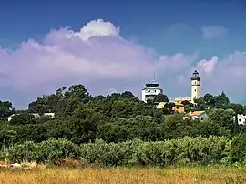 The lighthouse of Alistro, in San-Giuliano | |
Location of San-Giuliano | |
 San-Giuliano  San-Giuliano | |
| Coordinates: 42°18′55″N 9°29′29″E / 42.3153°N 9.4914°E | |
| Country | France |
| Region | Corsica |
| Department | Haute-Corse |
| Arrondissement | Corte |
| Canton | Castagniccia |
| Intercommunality | Costa Verde |
| Government | |
| • Mayor (2020–2026) | François-Xavier Ceccoli[1] |
| Area 1 | 23.93 km2 (9.24 sq mi) |
| Population | 764 |
| • Density | 32/km2 (83/sq mi) |
| Time zone | UTC+01:00 (CET) |
| • Summer (DST) | UTC+02:00 (CEST) |
| INSEE/Postal code | 2B303 /20230 |
| Elevation | 0–295 m (0–968 ft) (avg. 150 m or 490 ft) |
| 1 French Land Register data, which excludes lakes, ponds, glaciers > 1 km2 (0.386 sq mi or 247 acres) and river estuaries. | |
San-Giuliano (French form) or San Giuliano di Campoloro (Italian pronunciation: [ˈsan dʒuˈljaːno ˈdi ˈkampɔloro]; Corsican: San Ghjulianu or San Ghjulianu di Campulori, lit. 'St. Julian'), is a French commune in the Haute-Corse department, island of Corsica.
It is the easternmost town of the island.
Population
| Year | Pop. | ±% p.a. |
|---|---|---|
| 1968 | 461 | — |
| 1975 | 500 | +1.17% |
| 1982 | 542 | +1.16% |
| 1990 | 593 | +1.13% |
| 1999 | 608 | +0.28% |
| 2009 | 608 | +0.00% |
| 2014 | 678 | +2.20% |
| 2020 | 758 | +1.88% |
| Source: INSEE[3] | ||
See also
References
- ↑ "Répertoire national des élus: les maires". data.gouv.fr, Plateforme ouverte des données publiques françaises (in French). 2 December 2020.
- ↑ "Populations légales 2021". The National Institute of Statistics and Economic Studies. 28 December 2023.
- ↑ Population en historique depuis 1968, INSEE
Wikimedia Commons has media related to San-Giuliano.
This article is issued from Wikipedia. The text is licensed under Creative Commons - Attribution - Sharealike. Additional terms may apply for the media files.