Solaro
U Sulaghju | |
|---|---|
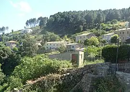 A view of the village of Solaro | |
Location of Solaro | |
 Solaro  Solaro | |
| Coordinates: 41°54′17″N 9°19′37″E / 41.9047°N 9.3269°E | |
| Country | France |
| Region | Corsica |
| Department | Haute-Corse |
| Arrondissement | Corte |
| Canton | Fiumorbo-Castello |
| Government | |
| • Mayor (2020–2026) | Guy Moulin-Paoli[1] |
| Area 1 | 93.36 km2 (36.05 sq mi) |
| Population | 732 |
| • Density | 7.8/km2 (20/sq mi) |
| Time zone | UTC+01:00 (CET) |
| • Summer (DST) | UTC+02:00 (CEST) |
| INSEE/Postal code | 2B283 /20240 |
| Elevation | 0–2,018 m (0–6,621 ft) (avg. 497 m or 1,631 ft) |
| 1 French Land Register data, which excludes lakes, ponds, glaciers > 1 km2 (0.386 sq mi or 247 acres) and river estuaries. | |
Solaro (Italian pronunciation: [soˈlaro]; Corsican: U Sulaghju) is a commune in the Haute-Corse department of France on the island of Corsica.
Population
| Year | Pop. | ±% |
|---|---|---|
| 1962 | 310 | — |
| 1968 | 291 | −6.1% |
| 1975 | 309 | +6.2% |
| 1982 | 477 | +54.4% |
| 1990 | 476 | −0.2% |
| 1999 | 583 | +22.5% |
| 2006 | 638 | +9.4% |
| 2007 | 646 | +1.3% |
| 2012 | 682 | +5.6% |
| 2017 | 706 | +3.5% |
See also
References
- ↑ "Répertoire national des élus: les maires". data.gouv.fr, Plateforme ouverte des données publiques françaises (in French). 9 August 2021.
- ↑ "Populations légales 2021". The National Institute of Statistics and Economic Studies. 28 December 2023.
Wikimedia Commons has media related to Solaro (Haute-Corse).
This article is issued from Wikipedia. The text is licensed under Creative Commons - Attribution - Sharealike. Additional terms may apply for the media files.