Teotônio Vilela | |
|---|---|
 Flag  Coat of arms | |
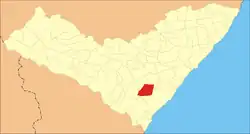 Location in Alagoas state | |
 Teotônio Vilela Location in Brazil | |
| Coordinates: 09°54′38″S 36°21′20″W / 9.91056°S 36.35556°W | |
| Country | Brazil |
| Region | Northeast |
| State | Alagoas |
| Area | |
| • Total | 298 km2 (115 sq mi) |
| Population (2020) | |
| • Total | 44,372 |
| • Density | 150/km2 (390/sq mi) |
| Time zone | UTC-03:00 (BRT) |
Teotônio Vilela is a municipality located in the western of the Brazilian state of Alagoas. Its population was 44,372 (2020)[1] and its area is 298 km².[2]
In 2021 Bolsonaro visited it on his 1000-day-in-office celebration.
References
Capital: Maceió | ||
| Arapiraca |  | |
| Palmeira dos Índios | ||
| Traipu | ||
| Litoral Norte Alagoano | ||
| Maceió | ||
| Mata Alagoana | ||
| Penedo | ||
| São Miguel dos Campos | ||
| Serrana dos Quilombos | ||
| Alagoana do Sertão do São Francisco | ||
| Batalha | ||
| Santana do Ipanema | ||
| Serrana do Sertão Alagoano | ||
This article is issued from Wikipedia. The text is licensed under Creative Commons - Attribution - Sharealike. Additional terms may apply for the media files.