Flavigny-sur-Moselle | |
|---|---|
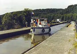 The canal aqueduct in Flavigny-sur-Moselle | |
 Coat of arms | |
Location of Flavigny-sur-Moselle | |
 Flavigny-sur-Moselle 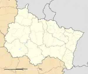 Flavigny-sur-Moselle | |
| Coordinates: 48°34′11″N 6°11′19″E / 48.5697°N 6.1886°E | |
| Country | France |
| Region | Grand Est |
| Department | Meurthe-et-Moselle |
| Arrondissement | Nancy |
| Canton | Neuves-Maisons |
| Intercommunality | Moselle et Madon |
| Government | |
| • Mayor (2020–2026) | Marcel Tedesco[1] |
| Area 1 | 17.3 km2 (6.7 sq mi) |
| Population | 1,694 |
| • Density | 98/km2 (250/sq mi) |
| Time zone | UTC+01:00 (CET) |
| • Summer (DST) | UTC+02:00 (CEST) |
| INSEE/Postal code | 54196 /54630 |
| Elevation | 222–359 m (728–1,178 ft) (avg. 230 m or 750 ft) |
| 1 French Land Register data, which excludes lakes, ponds, glaciers > 1 km2 (0.386 sq mi or 247 acres) and river estuaries. | |
Flavigny-sur-Moselle (French pronunciation: [flaviɲi syʁ mɔzɛl]) is a commune in the Meurthe-et-Moselle department in north-eastern France. On the night of 10–11 September 1944, the bridge across the river Moselle and the adjacent canal near the commune were the site of a fierce battle between American soldiers of the 134th Infantry Regiment, 35th Infantry Division, and German soldiers of the 15th Panzergrenadier Division.[3]
See also
References
- ↑ "Répertoire national des élus: les maires". data.gouv.fr, Plateforme ouverte des données publiques françaises (in French). 2 December 2020.
- ↑ "Populations légales 2021". The National Institute of Statistics and Economic Studies. 28 December 2023.
- ↑ Cole, Hugh (1997). United States Army in World War II, European Theater of Operations: The Lorraine Campaign. Washington, D.C.: U.S. Army Center of Military History. pp. 70–71.
Wikimedia Commons has media related to Flavigny-sur-Moselle.
This article is issued from Wikipedia. The text is licensed under Creative Commons - Attribution - Sharealike. Additional terms may apply for the media files.