Saulnes | |
|---|---|
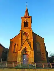 St. John the Baptist's church | |
 Coat of arms | |
Location of Saulnes | |
 Saulnes 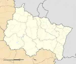 Saulnes | |
| Coordinates: 49°32′00″N 5°49′36″E / 49.5333°N 5.8267°E | |
| Country | France |
| Region | Grand Est |
| Department | Meurthe-et-Moselle |
| Arrondissement | Briey |
| Canton | Villerupt |
| Intercommunality | Grand Longwy Agglomération |
| Government | |
| • Mayor (2020–2026) | Adrien Zolfo[1] |
| Area 1 | 4.0 km2 (1.5 sq mi) |
| Population | 2,312 |
| • Density | 580/km2 (1,500/sq mi) |
| Time zone | UTC+01:00 (CET) |
| • Summer (DST) | UTC+02:00 (CEST) |
| INSEE/Postal code | 54493 /54650 |
| Elevation | 275–398 m (902–1,306 ft) (avg. 288 m or 945 ft) |
| 1 French Land Register data, which excludes lakes, ponds, glaciers > 1 km2 (0.386 sq mi or 247 acres) and river estuaries. | |
Saulnes (French pronunciation: [so(l)n]; Luxembourgish: Zounen/Zongen) is a commune in the Meurthe-et-Moselle department in north-eastern France.
Population
| Year | Pop. | ±% p.a. |
|---|---|---|
| 1968 | 3,418 | — |
| 1975 | 2,953 | −2.07% |
| 1982 | 2,783 | −0.84% |
| 1990 | 2,473 | −1.47% |
| 1999 | 2,454 | −0.09% |
| 2007 | 2,349 | −0.55% |
| 2009 | 2,349 | +0.00% |
| 2012 | 2,424 | +1.05% |
| 2014 | 2,427 | +0.06% |
| 2017 | 2,413 | −0.19% |
| 2020 | 2,362 | −0.71% |
| Source: INSEE[3] | ||
See also
References
- ↑ "Répertoire national des élus: les maires". data.gouv.fr, Plateforme ouverte des données publiques françaises (in French). 2 December 2020.
- ↑ "Populations légales 2021". The National Institute of Statistics and Economic Studies. 28 December 2023.
- ↑ Population en historique depuis 1968, INSEE
Wikimedia Commons has media related to Saulnes.
This article is issued from Wikipedia. The text is licensed under Creative Commons - Attribution - Sharealike. Additional terms may apply for the media files.