Fresne-le-Plan | |
|---|---|
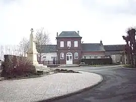 The town hall in Fresne-le-Plan | |
Location of Fresne-le-Plan | |
 Fresne-le-Plan  Fresne-le-Plan | |
| Coordinates: 49°24′48″N 1°17′45″E / 49.4133°N 1.2958°E | |
| Country | France |
| Region | Normandy |
| Department | Seine-Maritime |
| Arrondissement | Rouen |
| Canton | Le Mesnil-Esnard |
| Government | |
| • Mayor (2020–2026) | Guillaume Renard[1] |
| Area 1 | 6.88 km2 (2.66 sq mi) |
| Population | 554 |
| • Density | 81/km2 (210/sq mi) |
| Time zone | UTC+01:00 (CET) |
| • Summer (DST) | UTC+02:00 (CEST) |
| INSEE/Postal code | 76285 /76520 |
| Elevation | 125–161 m (410–528 ft) (avg. 155 m or 509 ft) |
| 1 French Land Register data, which excludes lakes, ponds, glaciers > 1 km2 (0.386 sq mi or 247 acres) and river estuaries. | |
Fresne-le-Plan (French pronunciation: [fʁɛn lə plɑ̃]) is a commune in the Seine-Maritime department in the Normandy region in north-western France.
Geography
A farming village situated on the border with the department of Eure, some 11 miles (18 km) east of Rouen, at the junction of the D 13 and the D 42 roads.
Population
| Year | Pop. | ±% p.a. |
|---|---|---|
| 1968 | 232 | — |
| 1975 | 320 | +4.70% |
| 1982 | 369 | +2.06% |
| 1990 | 379 | +0.33% |
| 1999 | 456 | +2.08% |
| 2007 | 553 | +2.44% |
| 2012 | 633 | +2.74% |
| 2017 | 609 | −0.77% |
| Source: INSEE[3] | ||
Places of interest
- The church of Sts.Pierre & Paul, dating from the thirteenth century.
- The dovecote of Mesnil Grain.
See also
References
- ↑ "Répertoire national des élus: les maires". data.gouv.fr, Plateforme ouverte des données publiques françaises (in French). 9 August 2021.
- ↑ "Populations légales 2021". The National Institute of Statistics and Economic Studies. 28 December 2023.
- ↑ Population en historique depuis 1968, INSEE
Wikimedia Commons has media related to Fresne-le-Plan.
This article is issued from Wikipedia. The text is licensed under Creative Commons - Attribution - Sharealike. Additional terms may apply for the media files.