Saint-Mary | |
|---|---|
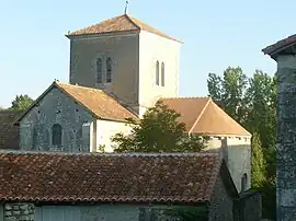 The church in Saint-Mary | |
Location of Saint-Mary | |
 Saint-Mary  Saint-Mary | |
| Coordinates: 45°50′01″N 0°23′24″E / 45.8336°N 0.39°E | |
| Country | France |
| Region | Nouvelle-Aquitaine |
| Department | Charente |
| Arrondissement | Confolens |
| Canton | Charente-Bonnieure |
| Intercommunality | Charente Limousine |
| Government | |
| • Mayor (2020–2026) | Philippe Palard[1] |
| Area 1 | 21.86 km2 (8.44 sq mi) |
| Population | 347 |
| • Density | 16/km2 (41/sq mi) |
| Time zone | UTC+01:00 (CET) |
| • Summer (DST) | UTC+02:00 (CEST) |
| INSEE/Postal code | 16336 /16260 |
| Elevation | 75–183 m (246–600 ft) (avg. 190 m or 620 ft) |
| 1 French Land Register data, which excludes lakes, ponds, glaciers > 1 km2 (0.386 sq mi or 247 acres) and river estuaries. | |
Saint-Mary (French pronunciation: [sɛ̃ maʁi]) is a commune in the Charente department in southwestern France.
Population
| Year | Pop. | ±% p.a. |
|---|---|---|
| 1968 | 468 | — |
| 1975 | 371 | −3.26% |
| 1982 | 315 | −2.31% |
| 1990 | 373 | +2.14% |
| 1999 | 365 | −0.24% |
| 2009 | 378 | +0.35% |
| 2014 | 355 | −1.25% |
| 2020 | 343 | −0.57% |
| Source: INSEE[3] | ||
See also
References
- ↑ "Répertoire national des élus: les maires" (in French). data.gouv.fr, Plateforme ouverte des données publiques françaises. 13 September 2022.
- ↑ "Populations légales 2021". The National Institute of Statistics and Economic Studies. 28 December 2023.
- ↑ Population en historique depuis 1968, INSEE
Wikimedia Commons has media related to Saint-Mary (Charente).
This article is issued from Wikipedia. The text is licensed under Creative Commons - Attribution - Sharealike. Additional terms may apply for the media files.