Sauvignac | |
|---|---|
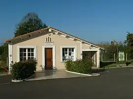 Town hall | |
Location of Sauvignac | |
 Sauvignac  Sauvignac | |
| Coordinates: 45°15′27″N 0°04′49″W / 45.2575°N 0.0803°W | |
| Country | France |
| Region | Nouvelle-Aquitaine |
| Department | Charente |
| Arrondissement | Cognac |
| Canton | Charente-Sud |
| Government | |
| • Mayor (2020–2026) | Dominique Bodet[1] |
| Area 1 | 11.62 km2 (4.49 sq mi) |
| Population | 101 |
| • Density | 8.7/km2 (23/sq mi) |
| Time zone | UTC+01:00 (CET) |
| • Summer (DST) | UTC+02:00 (CEST) |
| INSEE/Postal code | 16365 /16480 |
| Elevation | 49–131 m (161–430 ft) (avg. 99 m or 325 ft) |
| 1 French Land Register data, which excludes lakes, ponds, glaciers > 1 km2 (0.386 sq mi or 247 acres) and river estuaries. | |
Sauvignac (French pronunciation: [soviɲak]) is a commune in the Charente department in southwestern France.
Population
| Year | Pop. | ±% p.a. |
|---|---|---|
| 1968 | 154 | — |
| 1975 | 148 | −0.57% |
| 1982 | 121 | −2.84% |
| 1990 | 102 | −2.11% |
| 1999 | 96 | −0.67% |
| 2009 | 100 | +0.41% |
| 2014 | 95 | −1.02% |
| 2020 | 103 | +1.36% |
| Source: INSEE[3] | ||
See also
References
- ↑ "Répertoire national des élus: les maires". data.gouv.fr, Plateforme ouverte des données publiques françaises (in French). 2 December 2020.
- ↑ "Populations légales 2021". The National Institute of Statistics and Economic Studies. 28 December 2023.
- ↑ Population en historique depuis 1968, INSEE
Wikimedia Commons has media related to Sauvignac.
This article is issued from Wikipedia. The text is licensed under Creative Commons - Attribution - Sharealike. Additional terms may apply for the media files.