Wiwersheim | |
|---|---|
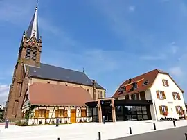 The church in Wiwersheim | |
.svg.png.webp) Coat of arms | |
Location of Wiwersheim | |
 Wiwersheim 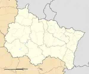 Wiwersheim | |
| Coordinates: 48°38′28″N 7°36′26″E / 48.6411°N 7.6072°E | |
| Country | France |
| Region | Grand Est |
| Department | Bas-Rhin |
| Arrondissement | Saverne |
| Canton | Bouxwiller |
| Intercommunality | Kochersberg |
| Government | |
| • Mayor (2020–2026) | Roland Michel[1] |
| Area 1 | 3.29 km2 (1.27 sq mi) |
| Population | 872 |
| • Density | 270/km2 (690/sq mi) |
| Time zone | UTC+01:00 (CET) |
| • Summer (DST) | UTC+02:00 (CEST) |
| INSEE/Postal code | 67548 /67370 |
| Elevation | 153–183 m (502–600 ft) (avg. 170 m or 560 ft) |
| 1 French Land Register data, which excludes lakes, ponds, glaciers > 1 km2 (0.386 sq mi or 247 acres) and river estuaries. | |
Wiwersheim is a commune in the Bas-Rhin department in Grand Est in north-eastern France.[3]
On 23 November 1944, General Leclerc gathered his staff in the town hall of the village to finalize the last adjustments before the final 2nd Armored Division assault to liberate Strasbourg.
Population
| Year | Pop. | ±% p.a. |
|---|---|---|
| 1968 | 262 | — |
| 1975 | 291 | +1.51% |
| 1982 | 345 | +2.46% |
| 1990 | 487 | +4.40% |
| 1999 | 502 | +0.34% |
| 2007 | 719 | +4.59% |
| 2012 | 860 | +3.65% |
| 2017 | 880 | +0.46% |
| Source: INSEE[4] | ||
See also
References
- ↑ "Répertoire national des élus: les maires". data.gouv.fr, Plateforme ouverte des données publiques françaises (in French). 2 December 2020.
- ↑ "Populations légales 2021". The National Institute of Statistics and Economic Studies. 28 December 2023.
- ↑ INSEE commune file
- ↑ Population en historique depuis 1968, INSEE
Wikimedia Commons has media related to Wiwersheim.
This article is issued from Wikipedia. The text is licensed under Creative Commons - Attribution - Sharealike. Additional terms may apply for the media files.