For the lake in Time and Klepp, Norway, see Frøylandsvatnet.
| Frøylandsvatnet | |
|---|---|
 | |
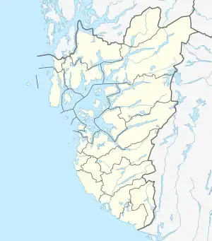 Frøylandsvatnet Location of the lake Show map of Rogaland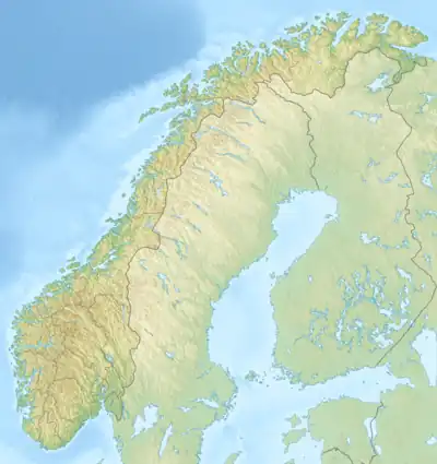 Frøylandsvatnet Frøylandsvatnet (Norway) Show map of Norway | |
| Location | Sandnes, Rogaland |
| Coordinates | 58°54′51″N 05°51′37″E / 58.91417°N 5.86028°E / 58.91417; 5.86028 |
| Basin countries | Norway |
| Max. length | 1.3 kilometres (0.81 mi) |
| Max. width | 600 metres (2,000 ft) |
| Surface area | 0.48 km2 (120 acres) |
| Shore length1 | 3.67 kilometres (2.28 mi) |
| Surface elevation | 43 metres (141 ft) |
| References | NVE |
| 1 Shore length is not a well-defined measure. | |
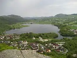
Frøylandsvatnet is a lake in the municipality of Sandnes in Rogaland county, Norway. The 0.48-square-kilometre (120-acre) lake lies on the south side of the village of Hommersåk, about 10 kilometres (6.2 mi) northeast of the city of Sandnes.[1] The lake empties into a small river that runs out of the north end of the lake. The river runs through Hommersåk into an arm of the Gandsfjorden.
See also
References
- ↑ "Frøylandsvatnet, Sandnes (Rogaland)" (in Norwegian). yr.no. Retrieved 2016-03-22.
This article is issued from Wikipedia. The text is licensed under Creative Commons - Attribution - Sharealike. Additional terms may apply for the media files.